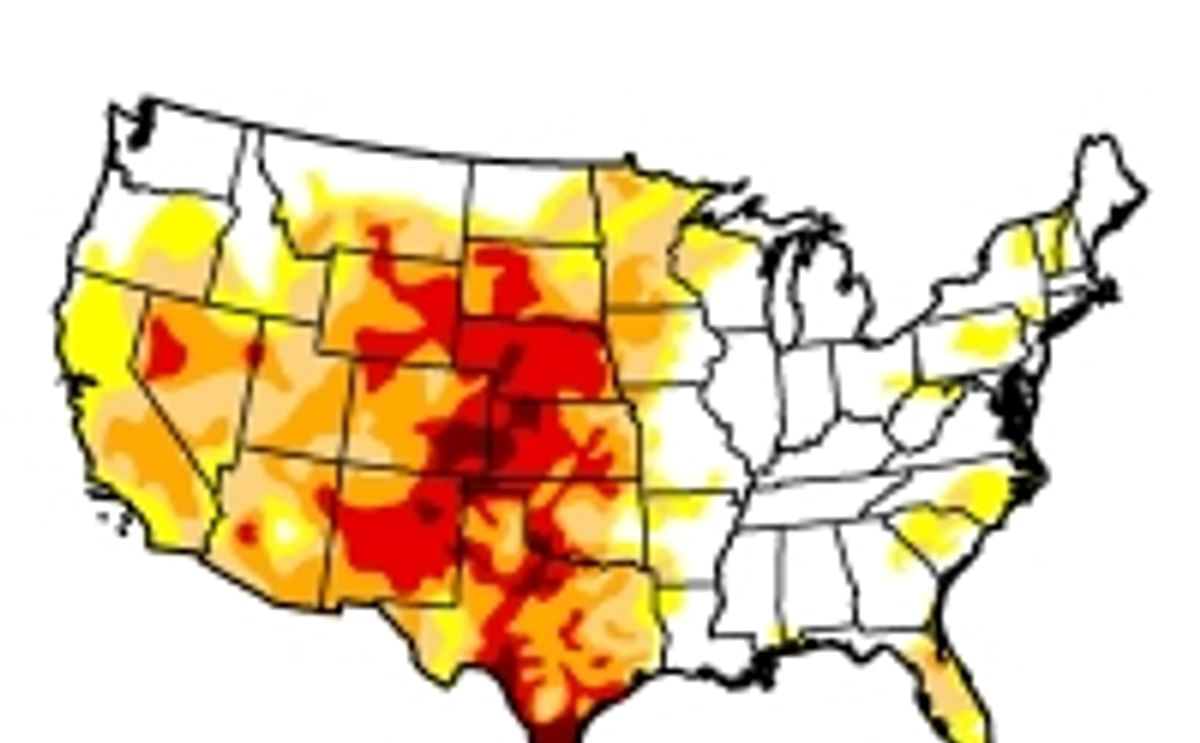
Earlier in April, the area in the United States in moderate drought or worse fell below 50 percent for the first time since June 19, 2012, according to the U.S. Drought Monitor. The area this applies to is the continental United States minus Alaska (contiguous United States).
Heavy precipitation across the Plains and the upper Midwest continued to ease drought. The area of the lower 48 states in moderate drought or worse declined to 47.82 percent, from 50.82 percent a week ago.
"We've been on a steady but slow recovery path from drought since the peak in September 2012,"said Mark Svoboda, University of Nebraska-Lincoln climatologist and a founding author of the monitor. "We've seen a much more active weather pattern lately across the midsection of the country, which has been eroding the intensity of drought as we head into spring. This is exactly what we needed."
Svoboda, the head of the Monitoring Program area at the National Drought Mitigation Center based at UNL, cautioned that improvement is still needed before the hot, dry season sets in.
Drought Monitor authors synthesize many drought indicators into a single map that identifies areas that are abnormally dry, in moderate drought, in severe drought, extreme drought and exceptional drought.
In the Midwest, heavy rains soaked into thawing soils and reduced drought in Minnesota, Iowa, Wisconsin and Missouri, observed this week's narrative accompanying the Drought Monitor map. The area of the Midwest in moderate drought or worse declined to 20.94 percent from 32.24 percent the preceding week, according to statistics released with the map.
In the Plains, drought receded in eastern Oklahoma, eastern Kansas, extreme eastern Nebraska and the Nebraska Panhandle, and most of the Dakotas. An area of exceptional drought, the worst category of drought, was eliminated from South Dakota. Heavy rains also improved conditions in Georgia, South Carolina and Florida. But decent precipitation eluded Texas and Arizona, which were among the few areas where drought got worse.
The U.S. Drought Monitor map is jointly produced by the National Drought Mitigation Center at UNL, the National Oceanic and Atmospheric Administration, the U.S. Department of Agriculture and about 350 drought observers across the United States. The map is released each Thursday based on data through the previous Tuesday morning.
Statistics for the percent area in each category of drought are automatically added to the U.S. Drought Monitor website each week for the entire country and Puerto Rico, for the 48 contiguous states, for each climate region, and for individual states. Data is archived to January 2000.
For the current U.S. Drought Monitor map, statistics and narrative summary, go to https://droughtmonitor.unl.edu. To compare the current state of drought with past months and years, go to https://droughtmonitor.unl.edu/archive.html.
Source: University of Nebraska-Lincoln
US area facing drought falls below 50 percent for first time in 10 months

¿Te gustaría recibir noticias como esta por correo electrónico? ¡Únete y suscríbete!
NEW! Join Our BlueSky ¡Canal para actualizaciones periódicas!
Contenido Patrocinado
Contenido Patrocinado
Contenido Patrocinado
Contenido Patrocinado
Contenido Patrocinado


